
№ 643 / Maps into motion
Fold the map into a location card
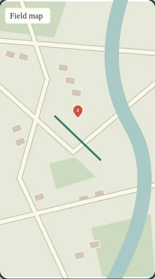
The line folds vertically into a small stamp, then the place name emerges from the same map coordinate.
IN EVERYDAY WORDS
Start at “Route open”. The line folds vertically into a small stamp, then the place name emerges from the same map coordinate.
The look
The line folds vertically into a small stamp, then the place name emerges from the same map coordinate.
Say this to a designer
On my property story, use “Fold the map into a location card”. The line folds vertically into a small stamp, then the place name emerges from the same map coordinate.
Direct the motion
These are starting points, not fixed rules. Match the timing to the content and the person using it.
- trigger
- Scrub “Fold the map into a location card”, replay, or advance with native scrolling.
- entrance
- Establish “Route open” so the viewer can recognize the starting state.
- path
- The line folds vertically into a small stamp, then the place name emerges from the same map coordinate.
- timing
- The complete replay takes 3.6 seconds. Keep each cue tied to its position in the sequence.
- easing
- Seek directly to the requested frame. Ease the movement between the authored poses.
- hold
- Settle on “Location card” so the viewer can inspect the consequence.
- exit
- Carry the discovery source, original question and chosen references into the next scene.
The vocabulary
- Fold the map into a location card
- The line folds vertically into a small stamp, then the place name emerges from the same map coordinate.
Make it fit your project
Good places to use it: property story, Maps into motion.
Use this when the viewer needs to follow the change from “Route open” to “Location card”.
Watch for: Keep the subject, orientation and interface legible throughout the change.
When motion is off: Choose “Route open” or “Location card” to inspect either still. Keep the full description available with motion off.
Implementation and accessibility
- Establish “Route open” using an owned photograph or an illustrative interface.
- The line folds vertically into a small stamp, then the place name emerges from the same map coordinate.
- Return to “Location card” using the end control and verify the result at phone size.
- Expose both named endpoints and a keyboard-operated control.
- Give spoken cues a readable visual equivalent.
- Load the active artwork on demand and share its frame calculation between scroll and replay.
Give it to your AI
Download the working source and example assets. Match this reference number in the included catalog to its renderer.
Replace [ELEMENT] with the part of your project you want to change. The prompt includes the design brief, motion direction, definitions, and implementation steps.
Read the full prompt
Use AI Acceleration Design Ref #643 (Fold the map into a location card, version 1) on [ELEMENT] in my existing project.

Permanent reference: https://aiacceleration.ai/designrefs/643. This local brief contains the full definition. Inspect my existing stack, component, design tokens and interaction before editing.

Goal: The line folds vertically into a small stamp, then the place name emerges from the same map coordinate.

DESIGN REF #643 · Fold the map into a location card

In everyday words: Start at “Route open”. The line folds vertically into a small stamp, then the place name emerges from the same map coordinate.

The look: The line folds vertically into a small stamp, then the place name emerges from the same map coordinate.

Say this to a designer:
On my property story, use “Fold the map into a location card”. The line folds vertically into a small stamp, then the place name emerges from the same map coordinate.

Motion direction (starting points to adapt):
Trigger: Scrub “Fold the map into a location card”, replay, or advance with native scrolling.
Entrance: Establish “Route open” so the viewer can recognize the starting state.
Path: The line folds vertically into a small stamp, then the place name emerges from the same map coordinate.
Timing: The complete replay takes 3.6 seconds. Keep each cue tied to its position in the sequence.
Easing: Seek directly to the requested frame. Ease the movement between the authored poses.
Hold: Settle on “Location card” so the viewer can inspect the consequence.
Exit: Carry the discovery source, original question and chosen references into the next scene.

Design vocabulary:
Fold the map into a location card: The line folds vertically into a small stamp, then the place name emerges from the same map coordinate.

Reduced motion: Choose “Route open” or “Location card” to inspect either still. Keep the full description available with motion off.

Implement:
1. Establish “Route open” using an owned photograph or an illustrative interface.
2. The line folds vertically into a small stamp, then the place name emerges from the same map coordinate.
3. Return to “Location card” using the end control and verify the result at phone size.

Adapt the reference to my branding and content. Preserve existing functionality and semantic HTML.
Reduced motion: Choose “Route open” or “Location card” to inspect either still. Keep the full description available with motion off.
Accessibility: Expose both named endpoints and a keyboard-operated control. Give spoken cues a readable visual equivalent.
Performance: Load the active artwork on demand and share its frame calculation between scroll and replay.
Avoid: Keep the subject, orientation and interface legible throughout the change.

Show me the working result, verify keyboard, mobile, loading/error and reduced-motion behavior, and explain any tradeoff. Do not publish or change unrelated elements.
Permanent reference #643 · version 1. Pairs with #029, #003.